Posts Tagged ‘remarkableohio’

RemarkableOhio almost 500

Tuesday, July 14th, 2009

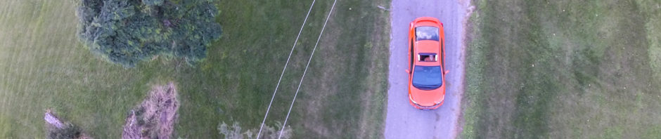
Over the weekend we did a little travelling.  I promised my wife a night out of town and since we were already going across the state to pick one of the kids up at church camp, it seemed like the perfect time.

We stayed in a nice bed and breakfast called The Barn Inn in Holmes county.  We weren’t planning on doing much other than resting, eating (it is Amish country) and taking some pictures.  Then without even looking, an historical marker showed up in the middle of the Amish community.

On the way home, we were sitting at a red light in Loudonville when we saw this one.

Outside of Perrysville, we passed this one and I actually turned around and went back to get a good picture.

No one in the car seemed to mind stopping to take a picture since we weren’t really out to find these markers.  That’s the way we have been doing them this year.  We spent last summer driving all around to find them.  Now we find them naturally along the path to wherever we happen to be going.

When I added these three markers to Flickr I noticed the count is approaching 500.  There are some duplicates, but we have a lot of unique pictures. See them all here.

http://www.flickr.com/photos/tags/remarkableohio

I should add one thing about that last picture.  A bird had left a nasty white mark over three lines of text.  The new version of Picasa easily removed the blemish.  If you haven’t looked at Picasa in a while, you should take another look.  I haven’t found another free picture manager that has nearly as many features.

Citrus Buzz

Sunday, July 20th, 2008

This one is for Buzz.

Latest From OHS

Tuesday, October 9th, 2007

I received a message from the Ohio Historical Society explaining how to see a map with all the markers for the state.  If you know how to do it, the feature has been there all along.

fullmapohs.png 

1 – Go to the search site – http://www.ohiochannel.org/your_state/remarkable_ohio/search_markers_01.cfm

and click Submit without entering any search criteria.  This will find all the markers in the state.  Be patient, it takes about a minute to load them all.

2 – When the full list appears, click the Map Markers link at the top of the list.  This will display the map shown above with over 1200 markers.

This is a regular Google map so you can pan and zoom.

The Last Straw

Monday, August 13th, 2007

Today we ventured out on a trip to Indianapolis.  Knowing the rest of the family would not want to get side tracked by my never-ending search for historical markers I did some extra planning ahead of time.  Everyone agreed that we would not go more than two miles from the Interstate taking us to our ultimate destination.  It wasn’t a problem, but I had to settle for markers that were well defined on the OHS site.  I found four with actual street addresses.

Piqua – Lock Nine
Troy – Junior Girls Canteen, 1943-1946
Troy – Overfield Tavern
Tipp City – Miami and Erie Canal Lock 15

All four were close to the Interstate.  We stopped at the first in Piqua.  We snapped a couple of pictures and were back on the highway.  The next stop was Troy.  I had two addresses there.

121 E Water St was suppose to be Overfield Tavern.  It was a museum with no marker.  It is also closed on Monday so we could not ask for help.  We went around the block a couple of times looking for the marker, but found none.

We headed over to 100 E. West Street.  This took us through the historic downtown.  There were (non-OHS) signs everywhere designating historic locations.  We enjoyed the ride.  A few blocks later we were on West Street.  We saw 26 on the first block and then 102 and 104 on the second block.  There is no 100 on East West Street.  We did the “around the block” thing again.  Nothing.  Judging from the picture on the OHS website, this marker is in or near a park.  There was no park on E. West Street in Troy.

We headed to Tipp City.

img_1405.JPG

The Lock 15 marker was suppose to be at 325 E. Main Street.  We found the lock, but there was no marker.  By this time we had blown almost an hour on this wild goose chase that was suppose to be an exercise in cherry picking.  Everyone in the car wass starting to get a little hot.  I did the only thing I could do… stopped at Dairy Queen.

Fortunately, the lady making the ice cream cones had lived in Tipp City since 1987.  She knew where the lock was.  She told us the marker was in the park beside the football field.  We gave that park a thorough search and found no marker.

We were one-for-four going after the low hanging fruit.  I think it’s time to write a letter to the OHS.

Over 200 RemarkableOhio Pictures

Monday, August 6th, 2007

Over the weekend I went to Ottenbein College to pick the kids up from band camp.  Before I left I scanned the OHS site to see if there were any markers on campus.  There were two plus one a few blocks away in downtown Westerville.  On the way home I scared everyone with my best impersonation of “Josh” and slammed on the brakes when I saw a marker beside the road.

blank-marker.JPG

Here’s a strange marker.  It’s the flip side of the  Benjamin R. Hanby memorial marker.  So far this is the only marker I have come across with printing only on one side.  Usually the back side of the marker is the same as the front side unless extra room is needed to finish the story on the front side in which case it is continued on the back.

After posting my last set, I checked the map and we are up to 202 pictures.  Many thanks to Mr. O for posting almost 50 pictures to our Flickr map.  Last week I stumbled upon his blog because he had posted a reference to an Ohio Historical Marker.  It turns out he has a nice collection.  I left a comment about the project we have going on Flickr and he tagged his pictures and added them to the map.

This is one of the great benefits of social networks.  Several people with similar interests can easily find each other and collaborate on a project for the benefit of the children.